RESOURCES
Some items used in the research of this site…

REFERENCES & SOURCES
First and foremost, I would like to profoundly thank several individuals who we used as a primary source for this website. We've connected with a few of them and they've provided additional information and resources on Low Frequency Radio Ranges, as well as critical feedback, that are now reflected on this website - their help was invaluable:
- AOPA Pilot’s Barry Schiff, a well-known pilot, author and AOPA editor wrote a great article on the LFR system and his personal experience with it back in 1997, posted here. A complete print version with diagrams can be found under downloads below. Additionally, he has a provided the recordings of an actual LF range and a 1962 "Cliff Notes" summary he coauthored that provided pilots of the era detail on how to use the system, also found under downloads.
- Tom Johnson and Ed Thelen have a great website dating from 2010 that covers details of the system, and they too located many existing sites. It served as the inspiration for me to pull this site together, found here. Tom Johnson compiled a complete history of all range stations in the country that drives the “Approx. Years in Operation” information on the Map page, and served as an invaluable resource to cross check our data. They've continued to provide additional station information as well as photographs that be found in the Photo Gallery under the Extra section and elsewhere on the site.
- Frank Dörenberg maintains an excellent website Radio Air Navigation through World War II that has great history and technical descriptions of early radio navigation systems, including the Low Frequency Radio Range. The site does an excellent job of citing and organizing its various source materials, including patents, scientific papers and period accounts. Frank was also intrigued by the differing accounts of how LFR originated (e.g. Otto Scheller, US Bureau of Standards, US Army and Ford) and helped dig through various online archives to retrieve sources that helped piece together a probable timeline.
- Bob Denny created a great series of YouTube videos starting with the “LF Range Navigation System” that recaptures the heyday of LFR utilizing old films and illustrations, including a 1940’s American Airlines Promo “Flagships of the Air”, and is well worth watching. For those of you “simmers” into X-Plane, his plug-in will recreate the 1940’s LFR system in the Western United States replete with period sectionals and approach plates. As a youth, Bob had nearly 200 hours sitting in the jump set of a DC-3 listening to the tones of the range.
- Richard Harris had developed a comprehensive article on the subject from 2013 (“Flying the Beam” LF/MF Four Course Radio Ranges) that can be found here.
Additional books and resources we used and where one can learn much more about the Low Frequency Radio Range System are as follows:
- Wikipedia has a great overview article here.
- Wikipedia also has a great article on the Transcontinental Airway Beacon System, the preceding system which paved the way for night time flight here.
- The Henry Ford Museum (“The Henry Ford”) maintains an excellent collection of everything that relates to the Henry Ford and his eponymous company and it also preserves Ford’s original Radio Range station, its equipment and other information of its early efforts and patent.
- “Beyond the Model T, The Other Adventures of Henry Ford”, by Ford R. Bryan, Wayne State University Press, 1997 contains an excellent overview of Ford’s development of its radio beacon.
- YouTube has a great WWII era training film from 1941 “US Signal Corps, Radio Aids” which provide excellent visual and overview of the details of the system here.
- A great overview of the early years of US airways can be found in "Flying the Beam: Navigating the Early US Airmail Airways, 1917-1941" by Henry Lehrer, Purdue University Press 2014.
- Another excellent overview of the early years of the US airways can be found in “Bonfires to Beacons: Federal Civil Aviation Policy under the Air Commerce Act 1926-1938” by Nick A. Komons, Smithsonian Press, 1989. An online copy is posted here.
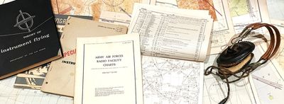
- The Army Air Forces “Instrument Flying Advanced with Radio Aids – Special Edition” Technical Order 30-100B-1, 1/15/44 provides a great contemporary overview of the system at its height.
- “Theory of Instrument Flying AF, Manual 51-38”, published by the Department of the Airforce April 1954 provided some additional coverage of the technical aspects of the system.
- I also found quite a bit of information in the book “Radio Navigation for Pilots – Instrument Flight, Part 2” Colin H. McIntosh, 1943 by McCraw Hill.
- The "US Department of Commerce, Bureau of Air Commerce, Aeronautics Bulletin #24 – The Federal Airways System, July 1936" provides a great overview of the system available here.
- An airline flight via LF Range is covered in the February 1936 Short Wave Craft Magazine “Flying the Radio Beam, How Short and Long Waves Guide Planes Along Airways” here.
- Information on day-to-day operations could be found in the March 1936 Popular Mechanics article, “Flying the Beams” including the remote telephone operation (it’s interesting how this article came out one month after the preceding article in a competing magazine) found here.
- An "Air Commerce Bulletin" issued September 15, 1929 discussed the nine initial range stations found here.
- The “Report of the Civil Aeronautics Board: Of the investigation of the accident involving civil aircraft of the United States NC 16086 which occurred near Centerville, Utah, on November 4, 1940” summarizes the crash of United Flight 16 due to a malfunctioning Salt Lake City range. This report dedicates nearly 70+ pages on the operations and ultimate failure of this site, with numerous detail and insights, found here.
- The website Air Traffic Control History provides excellent information on early ATC and navigation facilities, from the Transcontinental Airway Beacon System to the VOR complete with charts, personal histories and other chronology.
- David Frans and his company Airline Transport Communication (in conjunction with WWRB) recreated a working small-scale Low Frequency Radio Range in 2010 that was tested in real life from a small plane. You can find his video here.
- Ernie Brown in collaboration with Doug Leach created a 2018 presentation / talk “Radio Waves Across the North” that summarizes the spread of LFR during World War II across northwest Canada to connect to Alaska found here.
- The online article “The Radio Range, Communications and Aircraft Navigation” by Jack Chalmers and John Gilbert also contains great history on the radio range in Canada during World War II, its operators, and has a rare photo of the radio equipment within transmitter building, found here.
- The Kodiak Military Museum in Alaska contains excellent information on World War II and Cold War military installations in that state, including technical details and plans of some the range stations found here.
- The FAA presentation “Aircraft Navigation in the Aleutian Air War: World War II Civil Aeronautic Authority Radio Navigation in the Aleutian Islands” by Brice Environmental Services Corporation and the Federal Aviation Administration (May, 2020) contains a great summary of the wartime expansion of LFR in this region and includes several approach plates helpful for locating a couple sites found here.
- The paper “A Directive Type of Radio Beacon and its Application to Navigation” by F.H. Engel and F.W. Dunmore, National institute of Standards, Washington DC, 9/8/1923” contains a good overview of the US Government attempts to create a predecessor to the LFR, found here.
- The paper “Development of the Visual Type Airway Radio Beacon” by J.H. Dellinger, H. Diamond and F.W. Dunmore, National institute of Standards, Washington DC, 10/16/1929 provide the US Government’s account of the start of LFR between 1926 & 29. As discussed in the “Extra” section, this paper appears to ignore Ford's contribution and Patent. A copy can be found here.
- The Journal of Air Transportation, “Blind Flying on the Beam Aeronautical Communication, Navigation and Surveillance: It Origins and the Politics of Technology” Published in 3 Parts by Randy Johnson, 2003 (Vol. 8, No. 1, Vol. 8, No. 2) also contains a summary of the US Government’s early LFR research efforts. Part 1 found here. All parts can be downloaded from here.
- The paper “The History and Development of the Bureau of Standards Radio Beacon Experiment at College Park Maryland” by Robert W. Beckham, 12/18/1936 (written as “An Initiation Requirement for the Maryland Beta Chapter of the Tau Beta Pi Association”) captures detail of the early days of the Bureau Experiments at College Park, found here.
- The paper “A Tuned Course-Reed Course Indicator for the Four- and Twelve-Course Aircraft Radio Range”, by F.W. Dunmore, Bureau of Standards, Washington DC, published in the Proceedings of the Institute of Radio Engineers (Volume 18, Issue: 6, June 1930) provides an overview of the 12-course radio range system that never came to pass.
- The paper “The Development of a Visual Type of Radio Range Transmitter Having Universal Application of the Airways” by W.E. Jackson and S.L. Bailey, published in the December 1930 issue of the “The Institute of Radio Engineers” (Volume 18, #12) also described the promise and challenges of the visual and 12-course radio range, and compares the pros and cons, found here.
- The paper “Receiving Sets for Aircraft Beacon Telephony”, by Haraden Pratt and Harry Diamond, National Bureau of Standards, Washington DC, June 19, 1928 discusses the Bureau’s work to develop lightweight receiving sets for LFR.
- The Book “Principles of Aeronautical Radio Engineering” by P.C. Sandretto (who was the superintendent for the United Airlines Communication Laboratory), McGraw-Hill Book Company, Inc. New York and London 1942. Comprehensive textbook that describes the technical details of LFR and other radio technology in the early 1940’s, found here.
- Civil Aeronautic Authority, Technical Development Report No. 23. “Circuit Design for Low Frequency Radio Ranges”, by D.M. Stuart, US Government Printing Office, Washington, 1939/1941, provides another good overview of LFR radio transmitter design, found here.
- Civil Aeronautic Authority, Technical Development Report No. 14. “The Development, Adjustment and Application of the Z-Marker”, by W.E. Jackson & H.I. Metz, US Government Printing Office, Washington, 1938, provides a good description of this component, found here.
- The Technical Handbook “Maintenance of L/MF Range Equipment” SM P 6760.1 1964, Federal Aviation Agency, Washington DC, provides an in-depth technical description of LFR stations and their maintenance procedures, found here.
- “Federal Communications Commission Reports for July 1934 and 1935, Volume 1“(US Printing Office, Washington DC, 1936) documents the FCC’s ultimate denial to renew Ford’s LFR Station Licenses in dockets 2393, 2394 and 2395. The range station call numbers were W8XC Dearborn and W9XH Lansing.
- The site “Aviation Impact Reform” maintains an excellent year by year chronology of the history of Air Traffic Control in the United States, found here.
- The Bureau of Standard’s Paper “A Radio System for Blind Landing of Aircraft in Fog” By H. Diamond and F.W. Dunmore, Washington DC, 1930 describes the “Diamond-Dunmore” system, the first workable ILS system, found here.
- The Article “’Air Track’ system of Blind Linding”, by Charles E. Planck that appeared in the October 1937 Issue of Radio Craft Magazine (Radcraft Publications, Springfield Mass.), provides a good overview of the development of ILS between CAA and Lorenz systems in the late 1930’s, found here.
- The IEE Paper “First-Hand: Development of the Instrument Landing System Glide Path” by Leon Himmel, IEEE Life Fellow, Last Edited 2015, describes one scientist's first-hand account of the World War II development of ILS, found here.
- The Article “Diamond-Dunmore” in the April 1947 Federal Science Progress Magazine, US Department of Commerce, Office of Technical Services, Washington DC, provides another overview of the history of ILS, found here.

further information & RESOURCES
These sites were our “Go To” in term of obtaining old materials and maps:
- HistoricAerials.com: Probably the largest online repository of old aerials maps, many dating from the 40’s and 50’s.
- USGS Topoview: A great and easy resource to use to pull up historic topo maps of any given area.
- Library of Congress: Has a great online library of historic aeronautical sectional charts and other information that can be used to pin down LFR sites and their history.
- Flight Ontario has a downloadable cache of 48 Canadian World War 2 vintage charts at this link, which provides helpful coverage for this region. Please be aware that this an 80MB Zip File.
- McMaster University maintains an extensive online collection of World War 2 Era World Aeronautical Charts (WAC’s) that was helpful for areas outside of North America.
- Abandoned and Little-Known Airfields: This site has excellent documentation of many older facilities that were no longer with us. Many of the airport accounts contains snippets of contemporary aeronautical sectionals that can show the location of older low frequency ranges. This can be useful for establishing their location.
- NOAA Office of Coast Survey Historical Map and Chart Collection: Another good online map collection. While not as thorough as the Library of Congress this site does contain some sectionals, world aeronautical, radio facility and route charts that helped located many stations in Alaska, Northern Canada and Europe.
- Military Airfield Directory: The site contains a collection of airport facility, approach and radio facility charts from Europe dating from Cold War period (1945-1960). Along with a 1952 Route Chart that covered a large swath of Western Europe from Ireland to Italy, served as a primary source to provide a reasonably accurate identification of LF ranges in Europe.
- The New Zealand National Library has a good online collection of aeronautical charts and approach plates pertaining to that country and surrounding areas in the South Pacific.
- The Sheila Scott Map Collection also provides a variety of late 50’s and 60’s era aeronautical charts that were very helpful.
We are posting a few additional resources under downloads below that I’m hoping will be useful or anyone that want to track down a station in the Continental United States:
- August 1944 Army Air Forces Radio Facility Charts, Radio Facility Planning and Mileage Chart: These are 6 charts that cover the lower 48 states that show the ranges up and running at that time. This is a good place to see where stations existed relative to a location. The full manual provides 34 larger scale charts that covered each area in great detail and showed individual major airports and fan markers, but all of the low frequency ranges are show on the charts available here. As this is a work of the Federal Government, it is not copyrighted and thus in the public domain.
- August 1944 Army Air Forces Radio Facility Charts, Geographic Coordinates of Radio Air Navigation Facilities: As described above, this provide the latitude and longitude of each location and has been loaded in the map on the previous page. This is a .pdf of the same data that drives the map display on the other page. A great place to start a search is to input the station into Google Earth and see what’s there. Bear in mind the accuracy issues above. Once the location is established, check it against older aerials or contemporary USGS maps to find a station.
- Four-Course, Low-Frequency Radio Range History by U.S. State: Tom Johnson, who produced some of the source material / photos used on this site, created a comprehensive summary of the history of each LFR range by state. His list shows the status of most ranges in the US from 1929 to 1960, including changes in type, power and even location. This can be an invaluable aid for folks trying to track down a specific LFR site. Please note that this document is a working draft that may be incomplete in some areas and is subject to future updates.
All of what we did was from the “armchair” comfort of our home offices: frankly, it was a useful "shelter in place" pastime when we started in late 2020. It constantly amazes me how much is now available online. However, I know that there a treasure trove of old aerial images, maps, photographs, etc. that never made it to this medium sitting in old county archives, attics and musty file cabinets that might solve the mystery of the many stations we could not positively ID. Perhaps someone still with us has a distant memory of one of these stations, or navigating with them? If anyone has information on any of these own sites, please share per the Google Docs survey on the previous page.