MAP
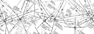
1944 Radio Facility Chart (Author's Collection)

Disclaimer: any information shown on this map is subject to additional updates/corrections. Please reach out to us below if you have any comments / additions) and of course, use none of this data for real world navigation.
Click on each station to uncover additional information, including geographic coordinates and, if we can determine it from the information on hand, the last station type that was used (many early loop stations were later upgraded to Adcock types) and approximate lifespan as seen on sectionals - special thanks to Tom Johnson for this information. Stations changed Morse code identifiers and frequencies over the years, but we do provide the identifier as listed in the August 1944 AAFRFC or other noted year. Beam alignments also frequently changed as the airways evolved and they would have been a herculean effort to catalogue. If one needs to study the specifics of station’s history in detail, we’d advise diving into the sectionals and other information on the Resources page. One tip: LFR courses shown on the charts were almost always given in local magnetic headings, and will need to be corrected to the magnetic declination of the era, as the magnetic poles have indeed shifted over the decades. Using current and historic aerial imagery, topo maps, old approach plates and other sources, our team worked to geo-locate stations to the nearest arc second or better, and checked to see what might be left at each location in available aerial imagery as of late 2020/early 2021. The locations are color coded as follows:
Yellow - Review Pending (11 or 1.2%): Historic aerials / maps with a scale larger than 1:1,000,000 have yet to reviewed by our team. This data is either raw coordinates from the AAFRFC which has varying accuracy as described below or has been roughly located with +/- 1 mile accuracy from an available smaller scale map or other source.
Green – Confirmed (360 or 40.9%): The location and status were confirmed and something remains of the station today (or at least in the most recent imagery), zoom in close and you can see for yourself. The odds of this are better in the west and the northern reaches of Alaska and Canada due to more open space. The markers are spot on (+/- 10’ accuracy) and this classification is broken in three tiers as follow:
- Dark Green - Intact (7 or 0.8%): The major elements, e.g. blockhouse, most antennae, and fence line remain. Basically, well preserved close to original form. There are two such stations in California, and one each in New Jersey, Florida, Alabama, Alaska and Quebec (the last two are very remote).
- Green - Remains (172 or 19.5%): Substantial remnants, e.g. a blockhouse, an antenna or at least all of the blockhouse / antenna foundations remain. The site may still be in use as an NDB or radio facility, albeit modified. Likely obvious to a person on the ground.
- Light Green - Trace (181 or 20.5%): Minimal evidence, e.g. a foundation of the blockhouse or one structure, traces of fence, vegetation footprint, etc. Likely not obvious to a person on the ground.
Grey - Confirmed: No Trace (330 or 37.5%): The station location was positively identified by an historic aerial or topo map; however, it is clear nothing remains of the station today – generally due to redevelopment of the site. This is especially common in urban areas and densely populated regions such as the Northeast. Locations identified by an aerial are also +/- 10’ accuracy, by USGS or other similar topo map closer to +/- 50 feet (<1 arc second).

Orange - More Review Needed (180 or 20.4%): The team's attempt to identify the precise location / status of a station was not successful. This is normally due to the lack of aerial photos and maps before 1970’s in certain areas by which point many stations were already gone, or the aerials from the time the station existed had low resolution or significant ground clutter making it tough to make out the station. Many transient wartime stations were set up and dismantled in the years between aerials surveys making them difficult to find. Although we know that the station existed based on the AAFRFC, sectional or other source, we simply don’t have the information to precisely pin on a map or say for certain what may be left of it today. Sometimes a possible candidate may be marked but needs further verification. That said, these locations were checked against sectional maps and the accuracy of has been refined to be within a quarter to half mile of the station’s probable location.
In summary, we’ve geolocated 690 or 78.4% of total stations identified. We’d love your help pinning the rest of these stations down, especially the “More Review Needed” and “Review Pending” categories. Do you know something more about any station on this site? Perhaps we totally missed a location? Do we have a “confirmed” location wrong? If so please fill out the Google Docs Survey below with any coordinates, notes, photos, etc. We are happy to continue adding to this database!
Please note that nearly all of these sites are located on private land or public land where access is restricted. Please obtain clear permission from the owner / relevant authorities before attempting to access any site – do NOT trespass!

EXPANSION OF LFR DURING WORLD WAR II
The Low Frequency Radio Range was the United States’ answer to developing a reliable all-weather commercial aviation industry, but as the Second World War loomed at the close of the 1930’s it was clear LFR would go on to play a crucial military role. As the US Government prepared for the inevitable war, one of its first great tasks would be to ultimately manufacture 300,000 warplanes for itself and the Allied Forces under the Lend-Lease program and simultaneously train 2.3 million pilots, airmen, ground grew, mechanics, etc. to fly them. Hundreds of new U.S. Army Airfields popped up across the country to handle this sudden demand, many with a range station to guide and train the new aircrews. The Royal Air Force in Canada responded similarly and developed its first cross-country “Green One” Airway with a 3,500-mile line of airbases connected by 36 range stations.
The second herculean task would be to safely deliver this immense number of aircraft, personnel and materiel across two vast oceans to the Allied Forces that desperately needed them in Europe and Asia. Within a year the Allied Transport Commands created several ferry routes, each thousands of miles long, with regularly spaced air fields, range stations, and other infrastructure to allow aircraft (especially shorter-range twin-engine bombers and fighters) to safely make it to their destination in a series of "hops." Several major ferry routes were established as follows:
- The Northwest Staging Route or Alaska Siberia (ALSIB) route: branched from the Green One Airway at Calgary / Edmonton, continued through British Columbia and the Yukon, then to Ladd Field in Fairbanks, the main transfer point to the Soviets. From there, aircraft would depart to the USSR via the Bering strait. This leveraged Alaska’s strategic location on the “great circle” route between North America and Asia, which had become obvious to wartime strategists by 1935 when General Billy Mitchell declared “he who holds Alaska will hold the world.” New aircraft, fresh from manufacturing plants in California and the Midwest, would first converge at Gore Field in Great Falls, MT to begin their journey northward. The route consisted of string of paired LFR stations and airfields roughly 100 miles apart. Nearly all sites were incredibly remote, and required live-in crews to provide around-the-clock airway communications and to maintain the facilities against the harsh environment. The Alaska Canada Highway was constructed shortly thereafter as a connecting road between the sites. The branching Aleutian LFR chain was built in anticipation and in direct response to the short-lived Japanese Occupation of Attu and Kiska islands there in 1942.
- North Atlantic Ferry Route: using the “Bluie” stations established at the start of World War II, northwest across Quebec to Goose Bay (via a series of stations to similar the Northwest Staging route), then to Greenland (Sondrestrom and Narsarsuaq), then to Reykjavik, Iceland and then on to the United Kingdom. Longer range aircraft could traverse the Atlantic via Newfoundland (Gander) and the Azores to the UK or Moroccan Coast. By 1943, LORAN provided an additional navaid for traversing the Atlantic.

- Mid Atlantic Ferry Route: from the US to Bermuda, then to the Azores to the Moroccan Coast or France after D-Day. Francoist Spain was technically neutral during the war and was not available to the Allies.
- Southwest Atlantic Ferry Route: from Florida to Guantanamo or Puerto Rico (Borinquen Field), the along the South American Coast (Atkinson, Natal and Recife Fields) and the across the Atlantic to Liberia (Roberts Field) or Sierra Leone (Hastings Field), then north along the West African Coast to the Mediterranean. Ascension Island was used for aircraft with more limited range. Half the aircraft destined for the USSR were sent via this route. This route also had additional branches that extended through Central Africa (Sudan and Eritrea) through the Middle East to India. Dead reckoning, celestial navigation and pilotage were essential skills, as LFR and other navaid coverage was sparse along much of the route and LORAN would not arrive in this region until well after the War.
- South Pacific Ferry Route: from Hawaii south through Christmas (Kiritimati), Palmyra and Kanton islands, then onward to New Caledonia and the Solomons and finally to Australia. Fiji and New Zealand would also have LFR facilities. Until LORAN became available by 1944, there were few radio navigation facilities over the vast featureless Pacific between island stations, so again, dead reckoning and celestial navigation proficiency was critical.
LFR’s navigation beams and communications line helped ensure that the planes and supplies made the journey, regardless of weather. Other key strategic areas that benefited from limited LFR coverage included the north coast of Africa along the Mediterranean and later, both ends of “the Hump”, the perilous supply route between India and China over the Burmese Himalayas. Additional stations were provided in the Marianas (Tinian and Guam) to support the bombing efforts against Japan. Later, LFR would help anchor the airways of the 1948-1949 Berlin Airlift, despite efforts by the Soviets to jam and bend its signals.

There was a terrible price paid for sending so many rapidly trained and inexperienced young men over vast, uninhabited stretches of the earth in complex aircraft: just on the Northwest Route alone, over 133 planes and their aircrews never made it from the Continental US to Fairbanks. Although millions made it to their destinations, a testament to the Transport Commands’ ability, thousands would be lost to adverse conditions as well as enemy action along these routes by war’s end.
After the war was over, much of North America, Western Europe and other once remote parts of the globe were blessed with an extensive network of airfields and range stations that became the foundation of the postwar aviation boom. Very likely, if you are in the US or Canada, your local municipal airport was born or heavily enhanced in this era. Although Europe had other solid radio navigation options, the expanding presence of US airlines and military forces kept a small network of familiar LFR stations in operation here and in other parts of the Pacific Rim until they were finally supplanted by VORs. Some old airfields and a few dozen range stations though were truly surplus with no real civilian need after the war, and faded from the landscape and charts during the 50’s and 60’s (in a few cases after a brief stint as a drag racing strip).
The air traffic control techniques and operational procedures developed during the war that successfully moved so many planes across the sky laid the groundwork for the world-wide system we take for granted today. The new long-range routes established across the Atlantic were adopted by commercial airlines and they sought the experienced wartime pilots that flew them to handle the post war travel surge. Gander, Shannon, the Azores and Canary Islands became common stops until the jet age finally enabled direct non-stop crossings of the Atlantic. The routes across the Canadian and Alaskan Wilderness would help open the area to the oil exploration that followed in the 60’s and 70’s. These routes were also used by the US and its NATO Allies in ensuring military readiness during the Cold War.
In short: the impact of the Low Frequency Range extended well past the borders of the United States and played a seminal role, among many other international contributions, in shaping global aviation history.

MAPPING METHODOLOGY: united states
For the United States and Lower Canada, the August 1944 Army Air Force Radio Facility Charts (AAFRFC) has been a “go to” primary source for locating old ranges, it provided what we would now call IFR (Instrument Flight Rules) en-route charts between major airports and range stations, as well as details of each facility. The 1955 Alaska Flight Information Manual (“Alaska FIM”) provided similar data for that state. In addition, we combed through US and some Canadian Sectional Aeronautical Charts (SAC’s) that can be found online especially at the Library of Congress, World Aeronautical Charts (WAC’s) that provided coverage of many parts of the globe, Route Charts (RC’s) and Radio Direction Finding Charts (RDF’s) all from the 1930’s through the early 60’s. Army Air Force Charts (AAF) provided coverage of many international areas during the Second World War as described below. There was a profusion of these charts and other manuals produced during and right after World War II. As of 2020, much of this material is working its way onto eBay and other sources from estate sales and other private collections. We’ve made a few of the more critical pages of the August 1944 AAFRFC available under the Resources tab.
The AAFRFC and Alaska FIM have tables that provide the latitude and longitude of many US stations. There were a few spurious errors in these here and there, e.g. a latitude and longitude switched, the given coordinates for a couple of sites seemed far from the nominal city (e.g. Atlanta – now corrected). But the data is generally accurate for 95%+ of most sites, and coordinates are provided to the nearest arc second. This sounds great as, in theory, an accuracy of one second of arc works out to be roughly 100’ on the ground. When the aerials were reviewed a few of these coordinates were indeed spot on; however, for most sites it became clear that the actual accuracy of the AAFRFC table ranged from a few hundred feet to a half mile, sometimes more. I personally believe that all of these errors were cause by limitations of the technology of the age (paper maps and scales), especially when the cartographers were constantly updating and disseminating this information during a frenzied wartime environment. Half/quarter mile accuracy was certainly good enough for this system, and I can’t imagine that a deliberate error would be enough to throw off an enemy agent attempting to locate a range station (something with five 135’ towers is indeed hard to hide).
Despite the location errors, many stations were easy to identify using current or historic aerials from the 30’s through 1960’s. Fortunately, most had a distinct square boundary and the blockhouse and antenna were clear. However, this was not always the case – the boundary could be disguised by underlying vegetation and other visual ground clutter. Additionally, these older aerials varied greatly in resolution – in some cases stations were quite clear down to detail of the antenna supports. Other aerials were so low-res that the blockhouse could barely be seen much less the antennae, especially if the sun was directly overhead when it was taken. In a few select cases historic USGS maps located range stations well enough to help with a positive ID, and in other cases contemporary aeronautical sectional charts provided enough clues (e.g. nearby rivers, intersections, airports) to help with an identification. Through this process we’ve been able to positively ID many stations and we’ve categorized them as “Confirmed” as described above.
A few LFR station sites ultimately became Formerly Used Defense Sites (FUDS) that had to undergo environmental cleanup during the late 20th and early 21st centuries. The United States Army Corps of Engineers (USACE), EPA and other agencies-maintained records of these efforts that helped identify sites.

mapping methodology: international
Outside of the US, it was a bit tougher to locate LFR station sites. The resources described above made it easy to locate US stations by identifying them off of old sectionals, then finding contemporary historic aerials or topo maps to geolocate the site. As the US Army Air Forces and Allies expanded their reach and the use of LFR across the globe, their cartographic departments produced the necessary WAC, AAF and Route Charts that showed station locations, albeit at a larger scale than the sectional charts, through the 1960’s. However, finding corresponding pre-1970's historic aerials and topo maps in other countries was often challenging. Also, while many LFR stations endured at foreign hubs heavily trafficked by US aviation, many other more transient wartime stations were removed shortly after the war’s end and were not well documented. Here are some regional specifics:
- Canada: Fortunately, many US aviation charts and the AAFRFC covered many Canadian locations and a cache of World War II Canadian Aeronautical Sectionals was located online; however, old topo maps, aerial photos and other historic aeronautical charts are harder to source online. Canada’s National Air Photo Library maintains an extensive online aerial archive going back to the 1920’s, and some provinces such as Newfoundland have similar online catalogues. Unfortunately, they charge significant fees for what is offered freely by other governments. There are other university or provincial websites where some aerials and topo maps can be accessed for free, but these are limited. Luckily, Canada’s sparser development made it easy to locate many former station sites on modern aerials, which allowed us to focus these resources on the others that were harder to find.
- Latin America: Beyond a few scattered Caribbean and Guiana Coast stations picked up on US charts, few LFR stations existed in in this region as it wasn’t traversed by critical wartime routes. Elsewhere, only three Mexican range stations near the US border were located.
- Europe and North Africa: With the exception of the UK Ordnance Survey, French Geoportail and Spanish Geoportal websites, it appears that as of 2020, pre-1970 historic aerials and maps for many parts of Europe are available mainly via commercial services (many with fees) that each only focus on a particular region. However, one site (the Military Airfield Directory) had numerous charts and approach plates for Cold War era European military bases. These plates typically gave bearings and distances from the runway thresholds to the utilized range stations which were very helpful.
- Australia and Oceania: The New Zealand National Library has plenty of old online aeronautical charts, approach plates, and imagery that covered much of that country and part of the Pacific Rim. Similar to Canada, historic charts / imagery was harder to come across in Australia but there were only a few LFR sites there.
- Central Africa and Asia: The few LFR sites in these regions were scattered along the old WW2 ferry routes as shown on AAF charts. The chief challenge is that there likely wasn’t much in the way of period historic aerials and maps to begin with, much less online. Indeed, some of these areas weren’t comprehensively mapped until the war. The next challenge is that in many areas, China especially, meandering river courses, population growth and major infrastructure changes makes it difficult to compare modern urban contexts to more rural landmarks mapped decades ago. As such, many locations will still show a “Review Pending” tag, as the best we could do is locate a station to about +/-1 mile based on an AAF, WAC or Route chart only. Given all of the undocumented changes that occurred over the decades, the exact location of many sites may be forever lost.
Although this all made it harder to find stations in these regions, we still believe that most, if not perhaps all, are reflected on the map above. Of note, the United Kingdom’s National Collection of Aerial Photography (NACP) has a large, but fragmented, worldwide collection of aerial photos, many dating from the end of the Second World War, that provided aerials of a few sites in Europe, Africa and Asia. Over time, we hope that many of these locations can be better refined/updated once appropriate aerials and other data can be found. If anyone has information in these areas, please reach out below.

EARLY "HOMING" & LOW POWER RANGES / STATIONS THAT NEVER WERE
For these people who really want to go into depth, here are is some additional information that came out of our research.
Inclusion of Homing Beacons in the AAFRFC: The 1944 AAFRFC listed 34 “Homing” beacons or NDB's among the US LFR stations we included on the map above. We’ve excluded NDB’s from later years, but we noted that that many on this list were converted from older LFR sites, or were constructed as complete range stations that were fully activated later on (in some cases, such as with Hamilton AFB in California, the LFR capability was never used). Given this ambiguity, we decided to include these first-generation “AAFRFC” NDB’s.
Low Power Airport Range Stations: During the 1930’s, some airports and airlines maintained small, low power loop ranges (type “ML”) that were 50 watts in power and had a 15-mile range that allowed an aircraft to home in more directly to an airport. They were physically smaller, only 60’ on side with 4 vertical triangular loops held between a 30’ center mast and four shorter corner masts. It was certainly not as good as a localizer or modern-day instrument landing system but it was a helpful aid. As these systems were smaller, they were never noted on topo maps nor do they show on the few early aerial photos available so we could not geolocate these. Here is a list of the ones we’ve identified:
- Burbank, CA - circa 1939
- Chicago Municipal Airport, IL - circa 1939
- Cleveland Municipal Airport, IL – circa 1938-40
- Fort Wayne, IN – circa 1939, operated by airport or TWA
- Harrisburg State Airport, PA – circa 1939, 265°, 2.5SM to field
- Islip Airport, NY – circa 1939
- Medford, OR – circa 1936-39. Multiple Locations, operated by United Airlines
- Memphis Municipal Airport, TN - circa 1939
- New Brunswick (Hadley Field), NJ – circa 1932
- Providence State Airport, RI – circa 1939, 1.5SM NE of field
- Salt Lake City Airport, UT – circa 1939
- Tacoma, WA – circa 1932-35
Proposed / “Under Construction” Stations that never entered service. Finally, again in the 1930’s, a number of stations were proposed or listed as Department of Commerce Lists, some were even marked as “Under Construction” on sectional charts, but it appears they never saw actual service (e.g. have beams radiating from this location on a sectional). As we assume that there is little / no physical evidence to locate them these were also not geolocated. Here is a list of the ones we’ve identified:
- Auburn, CA, Listed in 1931 but a range was never active here (a fan marker was placed instead)
- Fernley, NV, Listed in 1931
- Pontiac, IL, “Projected” 1931 in Department of Commerce Airways Diagram
- Shasta Springs, CA, Under Construction 1932
- Sweetwater, TX Under Construction 1932
- Wanship, UT, Shown on early undated map (1930’s?)
- Wellton, AZ, Under Construction 1932
- Willows, CA, “Proposed” 1931 in Department of Commerce Airways Diagram
Note: Alturas, CA was constructed in 1944 but was never shown as an active station on the sectionals. It appears it may have been one of a string of new stations (including Fallon and Tonopah, Nevada) that were constructed during late World War II to provide an inland route from Las Vegas to the Pacific Northwest that was never fully completed, perhaps unneeded after the war’s end? As this station has extensive remnants it was mapped above.

MAP OF THE VISUAL AURAL RADIO RANGE (VAR)
Finally, having identified most of the LFR sites and having added coverage of other systems, our team decided to make an effort to map all of the US Visual Aural Radio Ranges (VAR). Once planned as the next logical evolution of radio navaids after LFR there, its rollout was halted by World War II. By the time the conflict ended, technological progress leapfrogged the VOR ahead as a far better alternative. The US still began to roll out VAR stations in 1944, but they became obsolete nearly overnight when VOR debuted in 1946 and all would be converted to VOR or shut down by 1960. It is nearly a forgotten footnote in the history of navigation, but as it was indeed once a complete radio navigation system, we believed it merited more comprehensive coverage.
Instead of the AAFRFC that represented the heyday of the LFR network, we used the September 1950 version of its successor, the United States Air Force and United States Navy Radio Facility Charts (“Radio Facility Charts” or just “RFC” for short). It was printed at the peak of the VAR system and indeed it lists 66 stations. Unlike the AAFRFC, a table of helpful latitude /longitudes was not provided; however, having this list and overview charts help us track them down off of available historic sectionals. As we did with LFR, we were able to use historic aerials and USGS topo maps to pinpoint many station locations or at least a provide a position to within +/- a half mile (20’) of accuracy based on coordinates measured from the sectionals. These house-size stations had shorter lives and were much harder to identify than the sprawling, multiacre LFR sites; however, postwar aerial imagery was typically more frequent and sharper which helped offset this limitation.
In terms of the total number of VAR stations, a March 1949 CAA bulletin states “70” stations were in operation. In doing a census of Sectional Air Charts (SAC) from 1944 to 1960 our team counted 67 total stations. We also identified another 4 anchoring the ends of the Cold War era West Berlin Air Corridors overseas, where their singular, narrow visual beam may have been an advantage. Although the first VAR station at Matawan, NJ reportedly went on air in 1944, VAR didn’t appear on sectionals until 1946. Its rise and fall thereafter was incredibly rapid: within three short years its numbers peaked at 67, but 6 years later its total numbers had already fallen off to 10. A dwindling amount lingered until the last station at Norfolk, VA disappeared between the 1959 and 1960 chart cycles. Even at its climax, VAR was vastly outnumbered: by 1951 VOR already had 271 stations on-air, 4x VAR’s number, and LFR still had 384 stations (over 5x) in operation. The average VAR station was in service for only 5 years. A third of them were ultimately converted to VOR stations, most of the rest were quickly demolished and disappeared from aerials by the 1960’s.
At its maximum extent, VAR was, at best, a fragmented network with main stretches along the Eastern Seaboard, in the Midwest from Ohio to Texas and westward from Kansas to California. No stations appeared in Alaska or Hawaii. Like VOR, this network would have grown to mirror the LFR airways it was meant to replace, but history had other plans. The map legend is similar to what was provided for the LFR map above, the one exception is that a distinction is made between the one-third of total stations that were converted to VOR (many of which are still in service as of 2024) and other remains. A breakdown is as follows:
- Green – Confirmed (28 or 41.8%)
- Dark Green – Intact / Converted to VOR (23 or 34.3%)
- Green – Other Remains (2 or 3.0%)
- Light Green - Trace (3 or 4.5%)
- Grey - Confirmed: No Trace (19 or 28.4%)
- Orange - More Review Needed (20 or 29.9%)
- Total: 67 (100%)
Thus far, we’ve geolocated 47 stations or 70.1% of the original VAR network. As with LFR we hope that, over time, additional aerial imagery can be found to locate the rest.